Best for windless days, this DIY kit – developed by community researchers from Public Lab – enables you to take your own aerial photos from 1000 ft or higher. For windy conditions, complement it with a Kite Mapping Pack.
Using the open source tool MapKnitter, you can stitch the resulting images into an online map – your own “counter-cartography” version of Google Maps. Use it to tell a different story from the “official” map – document contamination (it was used to map the BP oil spill) or wetlands loss, or to record a temporary condition like the Occupy Oakland encampment.
To learn more about balloon mapping and get involved in the community, check out the open source documentation on the Public Lab website.
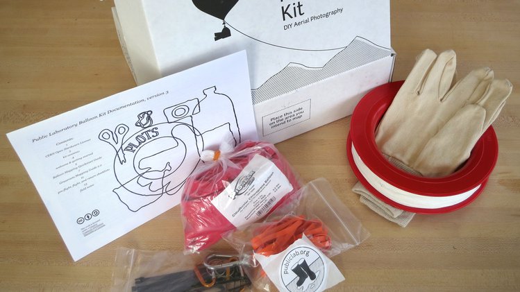
In addition to this kit, you’ll need a camera that can do continuous shooting and a 2-liter soda or juice bottle. Click here for details, but each kit includes:
*We are seeing 5-12 inflations if the balloon is minimally filled (40-50 cu ft) 3-5 if it is medium inflated (60-70 cu ft) and 2-3 inflations if the balloon is filled all the way to 80-85 cu ft.
 +1-786-628-7980
 Sign Up/Sign In