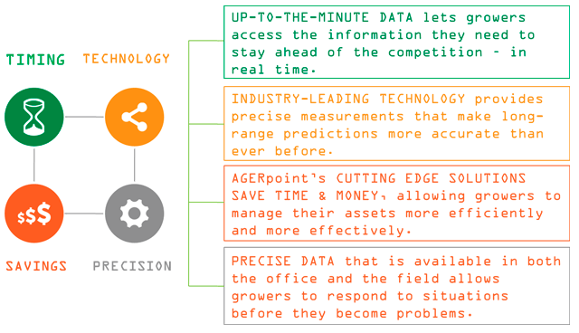
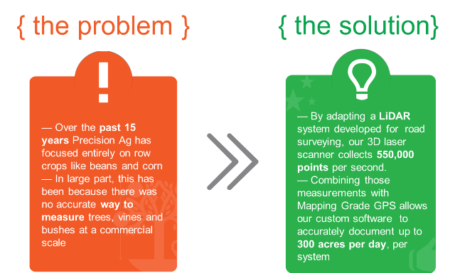
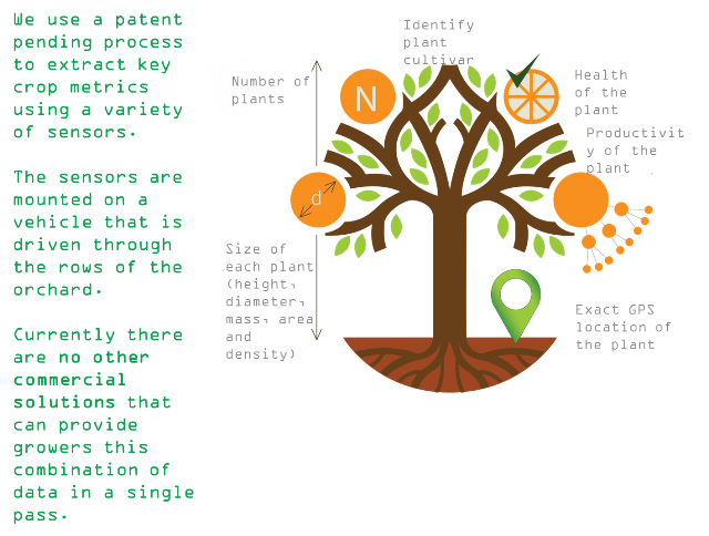
The level of accuracy AGERpoint’s system achieves has not been available before. Recent advances in LiDAR, GPS, and GIS have given AGERpoint the ability to collect a level of data not possible by any manual means. Our pending patent on this process means that we will be the only providers of this technology for years into the future.
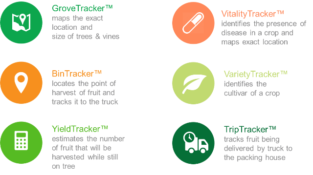
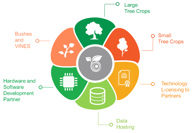
Our system also allows us to take a wide variety of measurements at the same time. With a single pass, AGERpoint can take comprehensive measurements of a tree’s size in three dimensions, count the fruit or blossoms on its branches, perform a spectral analysis of its leaves to ascertain its health, determine cultivar, and map it to precise GPS co-ordinates, providing a comprehensive inventory of a farmer’s assets in the field.
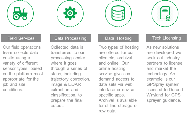
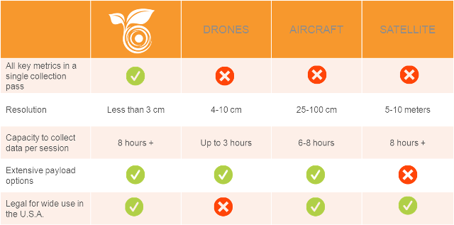
AGERpoint is also actively pursuing new technological advances in the collection and distribution of agricultural data. In the near term, our software platform will allow our clients to access all of their data from the field. A GPS enabled phone or tablet will be able to automatically pull up information on any tree or vine on their farm, either chosen from a detailed, custom map of the property, or based on a tree or vines proximity to the viewing device. Furthermore, while UAV (drone) technology cannot yet be used due to regulation and limits of the power available to power sensors, preliminary work is being done to make sure that such advances can be put into the field as soon as they are legal and practical. A UAV-based platform is expected to be able to measure 1,500 acres in a day, a five-fold increase over land-based scanning. Our data infrastructure has been designed to readily accommodate advances such as this well into the future.
 +1-786-628-7980
 Sign Up/Sign In